

Renaissance Maps - Four Archival Prints
Renaissance Maps - Four Archival Prints
Sheet size: Various sizes, see dimensions in the description
Sold without frame.
Couldn't load pickup availability
Delivery time within Sweden: 2-4 business days, within the EU: 4-7 business days. For special orders, such as hand-coloring or customization, delivery will be arranged by agreement.
Four archival prints showing how the image of the world and the Nordic region took shape during the first half of the 16th century, with maps by Johan Schöner and Sebastian Münster.
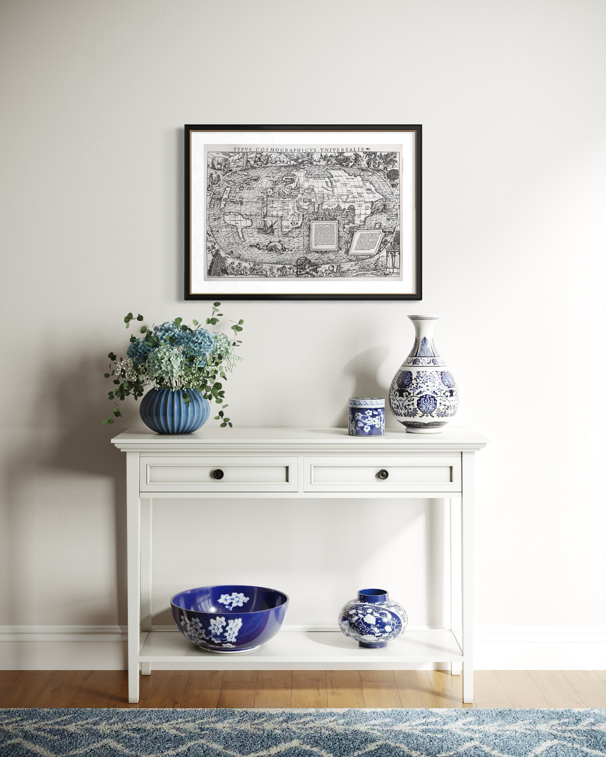
Contents: Schöner's northern and southern hemispheres from 1515, Münster's world map Typus Cosmographicus Universalis from 1532, and Scandinavia from Cosmographia from 1544.
Format, Schöner: Sheet 62 × 50 cm, image 41.5 × 41.5 cm per sheet.
Format, world map: Sheet 62 × 50 cm, image 58 × 39.5 cm.
Format, Scandinavia: Sheet 42 × 29.7 cm, image 36 × 26 cm.
Production: Older archival reproductions, not 16th-century originals.
Paper: Including handmade Lessebo paper and laid paper.
Optional: Hand-coloring based on historical originals, price on request.
Included: Fact sheet about the cartographers and the archive's background.
Frames: Not included.
The story behind the images
A cohesive quartet of the most fascinating cartographic works of the 16th century. This collection includes four early Renaissance maps that together depict how the Europeans' image of the world and the Nordic region took shape during the first half of the 16th century.
The package spans three crucial decades in the history of cartography: from Johan Schöner's globe from 1515 (divided into northern and southern hemispheres and visualized in globe segments), via Sebastian Münster's richly decorated world map Typus Cosmographicus Universalis from 1532 (with mythological creatures, ships, and marginal scenes attributed to Hans Holbein the Younger), to Münster's famous map of Scandinavia from 1544 from Cosmographia.
All four sheets are preserved archival copies from the print archive. My grandfather personally selected and restored the original editions and had them printed in small, limited editions of 100–300 copies using traditional printing techniques on quality paper (including handmade paper from Lessebo or laid paper). When the remaining copies in the archive run out, no new editions will be printed.
-
Contents (4 sheets):
-
Johan Schöner (1515): Globe, Northern Hemisphere.
Sheet dimensions: 620 × 500 mm. Image dimensions: 415 x 415 mm. -
Johan Schöner (1515): Globe, Southern Hemisphere
Sheet dimensions: 620 × 500 mm. Image dimensions: 415 x 415 mm.
-
Sebastian Münster (1532): World map, Typus Cosmographicus Universalis
Sheet dimensions: 620 × 500 mm. Image dimensions: 580 x 395 mm.
-
Sebastian Münster (1544): Map of Scandinavia from Cosmographia
Sheet dimensions: 420 × 297 mm. Image dimensions: 360 x 260 mm.
-
Johan Schöner (1515): Globe, Northern Hemisphere.
- Production: Older archival reproductions from Robert Weisz Hogens' print archive (not originals from the 16th century).
- Optional: Just as my grandfather once did, I can hand-color coastlines, compass roses, and marginal details by hand on request, based on historical originals. This makes your map set completely unique. Contact me for more information about the price.
- Ready to give away: Delivered carefully packaged together with the accompanying fact sheet about the cartographers Johan Schöner and Sebastian Münster, as well as the archive's background. (Frames not included).
Hanging and framing tips:
- Central composition: Let the wide world map Typus Cosmographicus Universalis (1532) serve as the centerpiece or top section, with Johan Schöner's two globe halves (1515) symmetrically on either side. The map of Scandinavia is well suited to be placed underneath.
- Matting and frame: Frame all sheets in identical narrow profiles in dark oak, walnut, black, or antique brass together with an off-white mat. This ties the different map formats together into a harmonious and decorative whole.
- Preserve the archival paper completely: I recommend that you do not trim the sheets, but instead mount them carefully with acid-free mounting tape at the top, behind the matting.
Product info
Product info
Paper size:Various sizes, see dimensions in the description
Print measurement:
Type of paper:
Printing technique:
Artist:
The publishing year of the original:
The print year of the reproduction: